5 Urban Design Trends Making E-Scooters a Permanent Fixture in Downtown Districts
Downtown streets used to belong almost entirely to cars. Sidewalks were for walking, and that was about it. But something shifted over the last few years. Cities started carving out space for bikes, then for e-scooters, and now for a whole new way of moving. The change is not accidental. It is the result of deliberate urban design trends that treat e-scooters not as a passing fad, but as a permanent piece of the transportation puzzle.
If you work in urban planning or city policy, you have likely felt the tension. Residents want the convenience of e-scooters. Business owners want tidy sidewalks. Safety advocates want protected lanes. The good news is that cities across the United States are proving these goals can coexist. The trends below show exactly how.
E-scooters are becoming a permanent fixture in downtown districts because of five converging urban design trends: dedicated micromobility lanes, geofenced parking hubs, smart traffic integration, 15-minute city planning, and data-driven infrastructure. These changes make e-scooters safer, more organized, and more useful for daily commuters and visitors alike.
Dedicated Micromobility Lanes Are No Longer Optional
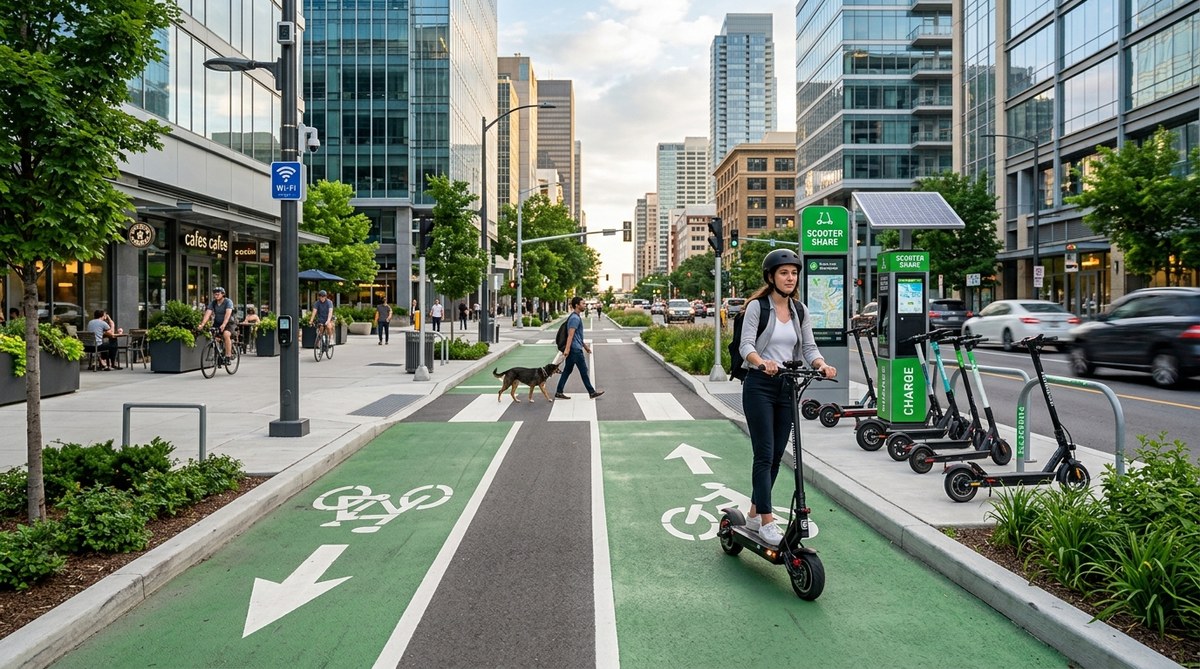
Sharing a narrow bike lane with cyclists and joggers is a recipe for frustration. That is why the most forward-thinking cities are building lanes designed specifically for devices like e-scooters. These lanes are wider than standard bike lanes. They have smoother surfaces to handle smaller wheels. And they are clearly marked so everyone knows where to ride.
Austin, Texas, is a good example. The city has been retrofitting major downtown corridors with protected micromobility lanes that separate e-scooters from both cars and pedestrians. The result is a noticeable drop in sidewalk conflicts. Riders feel safer. Pedestrians feel less crowded.
When planning these lanes, there are a few practical steps to follow:
- Audit your current street width and identify corridors with at least 12 feet of extra space.
- Consult with local micromobility operators to understand where riders naturally travel.
- Choose a lane width of at least 6 feet to allow two e-scooters to pass each other safely.
- Use physical barriers like bollards or raised curbs instead of painted lines.
- Install clear signage at every intersection to remind drivers and riders of the lane rules.
This approach works because it removes ambiguity. A rider knows exactly where to go. A driver knows where to expect them. And a city planner gets a measurable way to track usage.
Geofenced Parking Hubs End the Sidewalk Clutter
The most common complaint about shared e-scooters is the mess they leave behind. Scooters tossed on sidewalks, blocking doorways, or lying in the middle of a path. That problem is solvable. The solution is geofenced parking hubs.
These are designated zones, often marked with painted lines or physical docks, where riders must end their trips. The e-scooter app uses GPS to enforce the rule. If you try to park outside the zone, the ride does not end. You keep getting charged until you move it to the correct spot.
Cities like San Diego and Nashville have rolled out hundreds of these hubs in their downtown cores. The results are encouraging. Sidewalk clutter drops significantly. Business owners report fewer complaints. And riders appreciate knowing exactly where to find a scooter when they need one.
Here is a quick comparison of the two main approaches to parking infrastructure:
| Approach | How It Works | Best For |
|---|---|---|
| Virtual geofenced zones | GPS enforced; no physical hardware | High flexibility, low upfront cost |
| Physical docking stations | Locking mechanisms; solar powered | High compliance, durable long term |
Both methods have a place. Virtual zones work well for temporary event spaces or areas still under construction. Physical docks make sense in high traffic intersections where order is non negotiable.
Smart Traffic Integration Gives E-Scooters Their Own Signal
E-scooters do not belong in crosswalks with pedestrians, and they do not belong in the middle of car traffic. But at a busy four way intersection, where do they go? The answer is a dedicated signal phase.
Cities like Seattle and Denver are experimenting with traffic lights that include a specific signal for micromobility vehicles. When the light turns green for e-scooters, cars get a red light and pedestrians get a walk signal. This separation reduces the most dangerous kind of collision: the right hook turn where a car cuts off a rider.
The technology behind this is surprisingly simple. Sensors embedded in the pavement detect approaching e-scooters. The traffic controller adjusts the signal timing to give them a safe window. Over time, the system learns the patterns and optimizes the flow.
This trend is still in its early stages, but it points toward a future where e-scooters are treated as a distinct mode of transportation, not an afterthought.
The 15-Minute City Model Makes E-Scooters Essential
The 15-minute city concept says that every resident should be able to meet most of their daily needs within a 15 minute walk, bike ride, or scooter ride from home. That means grocery stores, pharmacies, parks, schools, and transit stops all within a short radius.
E-scooters fit perfectly into this model. They cover the gap between walking and driving. A trip that takes 25 minutes on foot takes only 8 minutes on an e-scooter. That difference turns a chore into a convenient errand.
Portland, Oregon, has embraced this idea by zoning its downtown neighborhoods for mixed use development. New buildings must include ground floor retail. Streets are designed for slow speeds. Parking requirements are reduced. And e-scooter parking is included in the building permit process.
For planners, this means thinking about e-scooters from day one of a project, not adding them as an afterthought. When a new apartment building goes up, it should include a scooter parking zone just like it includes a bike room.
“We stopped asking whether e-scooters belong in our downtown. We started asking how to design streets that make them work for everyone.” — Urban mobility advisor, City of Portland
Data Driven Infrastructure Lets the Numbers Lead
Guesswork is not a good strategy for allocating street space. That is why more cities are using real time data from e-scooter operators to decide where to build lanes and parking hubs.
Every shared e-scooter sends data about its location, speed, and route. Aggregated and anonymized, this data shows planners exactly where people ride most. It reveals the desire lines that no survey could predict.
For example, if thousands of trips start at a transit station and end at a commercial district three blocks away, that corridor is a strong candidate for a dedicated lane. If a particular intersection sees frequent near misses, it might need a signal adjustment or a physical barrier.
Los Angeles uses a data dashboard that updates every 15 minutes. City officials can see scooter density, average speeds, and parking compliance across all operators. This transparency helps them hold companies accountable and make smarter decisions.
Here are the key data points to track:
- Trip origin and destination clusters
- Average speed per corridor
- Parking compliance rates by neighborhood
- Accident or incident reports with location tags
- Ridership volume by time of day and day of week
Using this data, a city can move from reactive policing to proactive design. Instead of waiting for complaints, you can spot a problem before it becomes a crisis.
What This Means for Your Downtown District
These five trends are not theoretical. They are being tested and refined in cities across the country right now. The cities that adopt them will have safer streets, happier residents, and a transportation network that actually works for the 21st century.
If you are an urban planner or city official, the path forward is clear. Start with one corridor. Install a protected lane. Add a geofenced parking hub. Watch the data. Adjust as you go. The e-scooter is not going anywhere. The question is whether your downtown will be ready for it.
For more on how these devices fit into the bigger picture, check out our guide on how e-scooters are reducing traffic congestion in major cities and our analysis of what urban planners need to know about micro-mobility infrastructure. These resources offer a deeper look at the numbers and the strategies that work.
The best time to start planning was five years ago. The second best time is today. Take a walk through your downtown. Look at the streets with fresh eyes. Imagine a lane for e-scooters, a hub for parking, and a signal that gives them space. Then start the conversation with your team. The design trends are already here. It is time to make them permanent.
